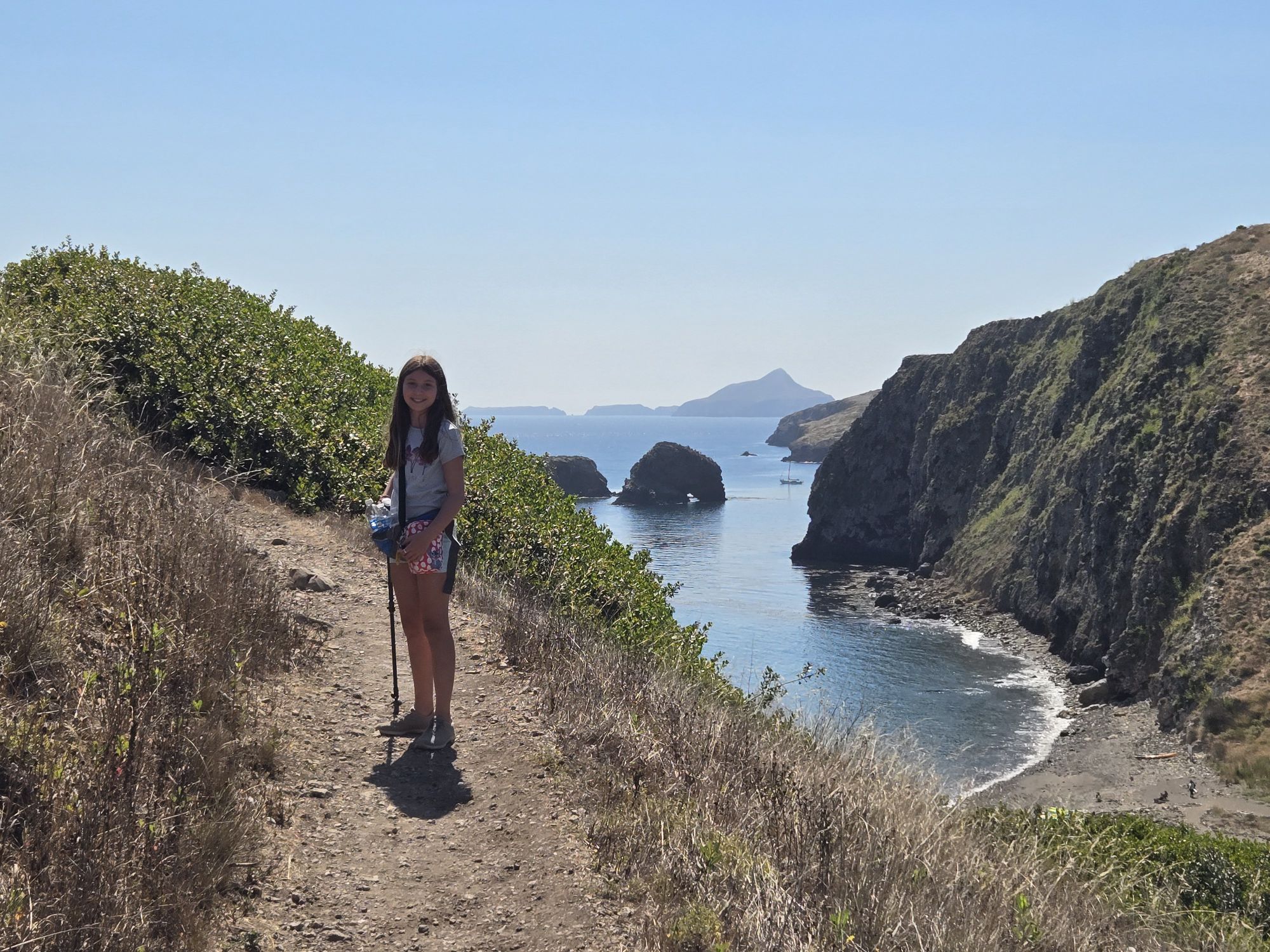
Earlier this year, I visited five national parks.
Why not add a sixth?
I had the first week of October off as a quarter break, and my mom had always wanted to see Great Basin National Forest. I’d always wanted to drive Highway 50, the “Loneliest Road in America,” so it seemed a great time to tick both of those boxes.
I didn’t bring Daughter on this trip, since she had school and Great Basin wasn’t high on her list. This worked out better for me, since there’s no way she would’ve done Highway 50. If she were included in this trip, we would’ve flown into Salt Lake City.
So her path to 63 is still stalled out at six. If you can call it “stalled out” if she’s added four in a span of seven months. And we might or might not hit Joshua Tree when we visit SoCal for Christmas. Stay tuned…
Baker, Nevada
Although we didn’t fly into SLC, we did in fact circle through there to get to Great Basin. We hit a Boise State Football game and the Golden Spike National Monument (where the first transcontinental railroad was connected) just north of Salt Lake. The whole round trip was over 2,000 miles. Good thing I had a rental car.
So we actually started at the eastern edge of Highway 50, coming in from Utah, which was the opposite of how I always envisioned driving it. Who knew a road goes BOTH directions?
My initial thought, before even getting into Nevada, was that Highway 50 might be the loneliest for humans, but not for bugs. We went over a mountain that Google tells me is called King Top, but which at the time I could only assume was the River Styx, shortly after sundown. Holy Hell! How many plagues deep are we when the locusts kamikaze against the front of your car?
We stayed at a place right on the border of Utah and Nevada, calling itself a hotel and casino, with a very liberal use of both words.
And by “right on the border,” I mean it pretty much straddled it. The hotel portion of the property was in Utah, while the casino portion, obviously, was on the Nevada side. Bear in mind, Nevada and Utah are in different time zones. They told us our check out time was 10:00 am. I didn’t have the wherewithal to ask WHICH 10:00 am, considering the hotel office was in the casino portion.
This played havoc with my electronic devices not just when we were at the hotel, but the entire next day. My car believed we were in Pacific Time, while my watch thought we were in Mountain Time. My phone, which was “roaming” for the first time since the Bush administration, tried to split the difference with this beauty of a save screen:

While it seems like it’s a standard screen for traveling, I’m ninety percent sure it hadn’t been giving me the “Local/Home” split the previous day when we were in Idaho and Utah, which are firmly in the Mountain Zone instead of straddling the two zones. Plus this split times showed up the entire day we were in the Great Basin National Park, which is 100% in the Pacific Zone, but I’m guessing, being on the eastern side of a mountain, was getting all of its (roaming) cell phone signal from Utah.
The casino, meanwhile, consisted of about twenty slot machines that didn’t pay out. They didn’t even print a ticket. When you wanted to cash out, you had to go get the bartender to come zero out the machine, then go back to the bar and get some cash out of the till for you. I usually like going from slot to slot, but didn’t want to keep pulling her away from her primary job.
The hotelish/casinoish also had a restaurant. Ish. That was one of the main reasons we booked it. Unfortunately, we were informed when checking in that the restaurant is open 8:00 am to 9:00 pm, every day. Except for tomorrow.
I don’t know if the “except for tomorrow” was because it was a Sunday night. Or the last day of the month. Or because the bartender had to empty out the slot machines. All I know is that we were only staying one night. The person checking us in knew we were only staying one night. So the “except for tomorrow” information, for us, might as well have meant never. She might’ve wanted to lead with the fact that there was no breakfast for us instead of telling us the regular hours that we would never encounter.
Fortunately, we found a solid spot for breakfast in the town of Baker the following morning. I say “fortunately” because it was the only spot in town. If it had totally sucked, it was still where we were having breakfast.
But it didn’t suck.
There were only three things on the breakfast menu, along with three things on the lunch menu. I was a little skeptical when those three breakfast items were a sandwich, a burrito, and a quiche. Those all seem rife for being torn out of a plastic bag and thrown in the microwave. Damn you, Starbucks!
I was thrilled, then, when what I can only assume to be the sole proprietor spent ten minutes in the back putting some TLC into our breakfast. The sandwich featured an egg/cheese “brick” between a cheddar biscuit, both items of which were homemade. The brick didn’t sound appealing, and I’m still not entirely sure how it was made, but the texture was fine and the flavor was good. Kinda like a quiche that’s been run through a vice. And the cheddar biscuit, holy crap! This woman might be the sole reason Red Lobster went out of business.
Plus a very stripped down espresso menu. Lattes and cappuccinos plus a handful of Torani syrups if you absolutely must. I enjoy a coffee shop that caters to people who enjoy coffee instead of sugar bombs.
They didn’t have dinner on the menu, but we noticed there was a back room with a full bar, so I’m guessing when all two hundred town inhabitants get off work, they enter through the other side of the building where they see a dinner menu. Outsiders have to go to the Mexican restaurant, which was the only other dining establishment in town.
We also frequented what might’ve been the only store in town – it had everything from books and clothes to some minor groceries. All in one room.
But the most important thing we got there, the item that ended up dictating the course of the journey back home, was free. A Highway 50 stamp passport. To complete it, you have to stop at all the random little hamlets you’d normally blow past.
Challenge accepted!
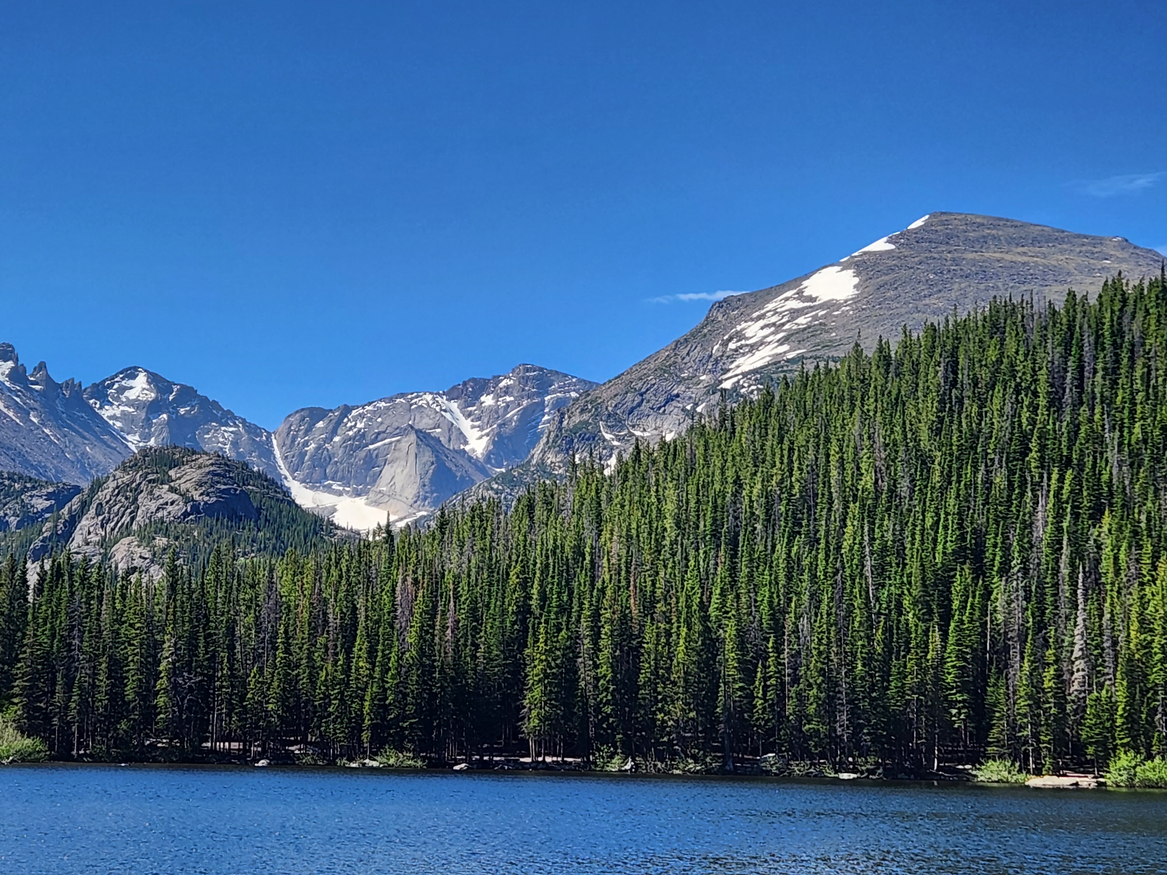
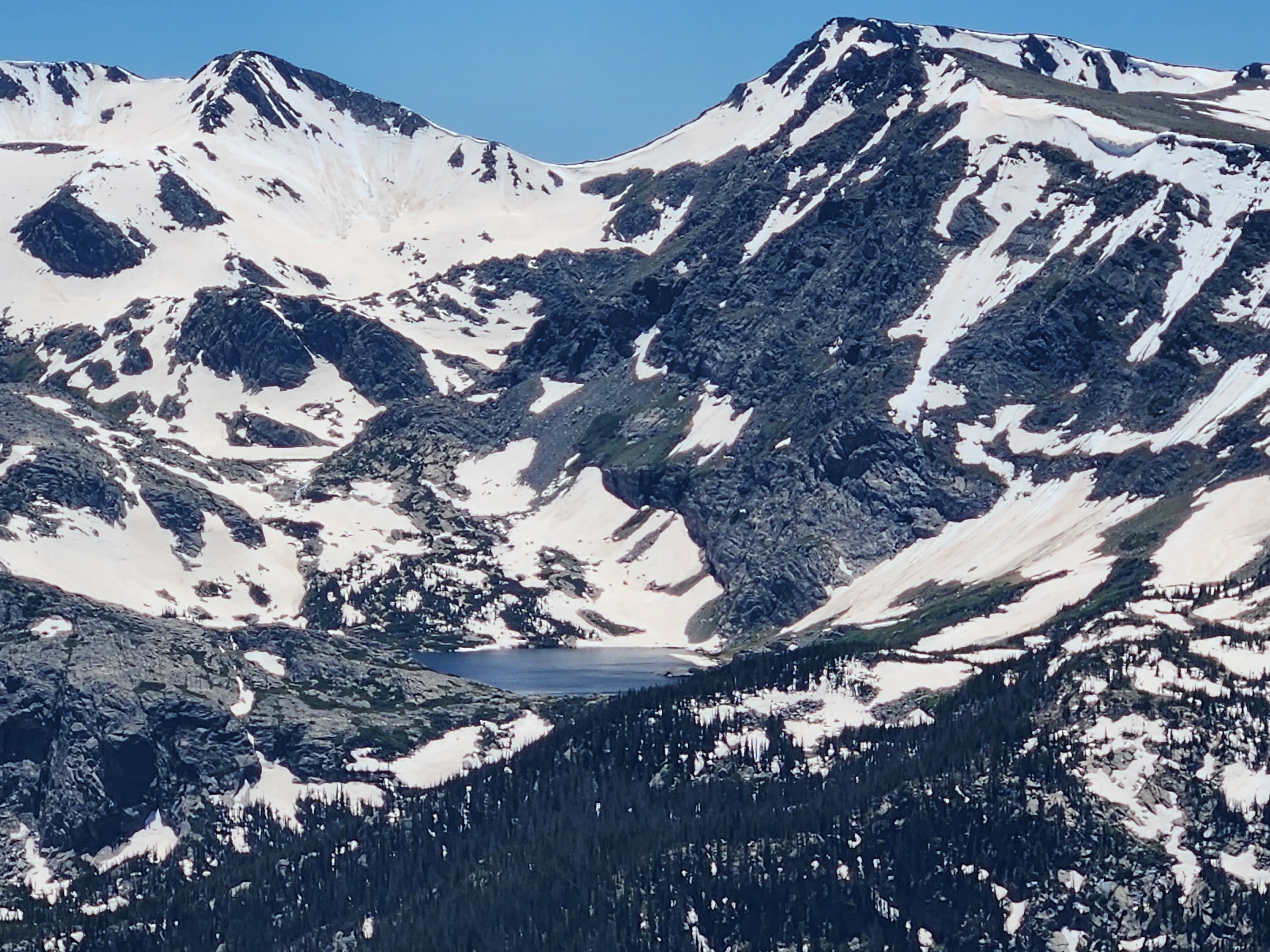
Great Basin National Park
In terms of how prepared I was going into a new national park, Great Basin was down on the “I’ve vaguely heard of it” end of the spectrum. My mom was the driving factor here, so I let her do the research.
Her primary interest in Great Basin was not the lakes and mountains and shit I usually focus on, but for astronomy. Being up in the high desert with nary an electrical light in sight, this park is “certified dark sky” and known for stargazing. We had some great views of the sky the night before, especially the few times the damn bugs got out of the way.
There’s an observatory in the park. Unfortunately it’s a) primarily in use at night, and b) closed to the public. At multiple locations, we asked, just out of curiosity, where in the park the observatory was and the only response we ever got was “it’s closed to the public.” Even when we assured them we weren’t going to go bother the scientists or aliens, we just wanted to know where the heck it was, we were told “only the employees can go there.”
Sheesh, even Area 51 has fucking signs!
Great Basin also has a solar telescope, which, follow me here, is in use during the daytime. Even better, it’s accessible to the public. Because the aliens are at work during the day. Unlike the nighttime telescope, employees actually answered questions about the solar telescope and we only had to ask three or four times to learn that the it was located behind the visitor’s center.
Unfortunately, when we went there, we saw no telescope. We hiked up a trail and still no telescope. We returned to the visitor’s center and asked the same employee if we somehow missed it, she responded, “Oh, sorry, it’s only set up Thursday through Sunday.”
Clearly E.T. and the chef at the casino like to take days off together.
Another of the park’s main draws is also currently off limits, but for a different reason. The Lexington Arch, which looks spectacular, currently has a washed out road, adding a couple miles each direction to the regular trail that was already five miles. The wash-out happened in 2013. So I’m sure they’ll get around to it, you know, sometime. Unfortunately, up to this point, the only thing they’ve had a chance to do is change all the permanent maps to tell us the road is “temporarily” washed out.
Fortunately the other main draw of the park, the Lehman Caves, are fully accessible and open midweek. Only two tours with twenty tickets each, so get there early.
I actually thought we had missed the first tour, because the tour was at 10:30 and my watch said it was 10:40. I said as much to my mom, prompting someone nearby to remind me that my watch was in a different time zone. Great, we still have close to an hour!
Unfortunately, the 10:30 tour was already sold out, so we bought tickets to the 1:30 tour, which of course we were going to be an hour early for because of the Baker, NV time warp.
The caves were fun, as are most caves. The stories of Absalom Lehman, who “discovered” the caves (that had been in use by Native Americans for a thousand years), were hilarious. He built a shack over the entrance and, for a dollar, sold you a candle and let you in. He said if you weren’t back in 24 hours, he’d come looking for you.
He also, unfortunately, had a rule of “If you can break it, you can take it,” leading to a number of broken stalactites and stalagmites. Although it does give us a good barometer for how long the various columns took to form. The caves became a national monument in 1922, so we can assume the “new growth” in this photo represents about a century of progress:
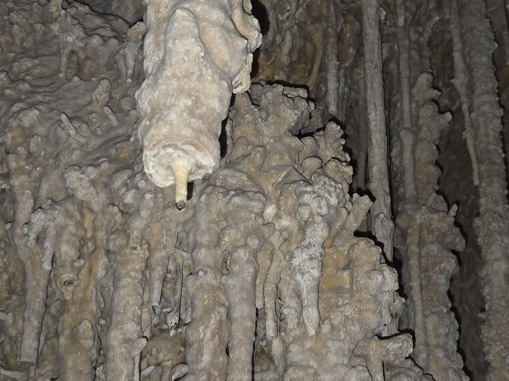
Which, of course, just makes the rest of the cave all that much more impressive. So, thanks, I guess, Mr. Lehman? Your assholery destruction of nature’s majesty helps us… appreciate it more?
We took the “short tour,” which only goes into the first chamber, then returns to the entrance. There’s a longer one that was finishing shortly after ours, coming out of a different exit. I didn’t see it as an option on any of the boards, so I assume it needs to be booked ahead of time online. I’ll be checking that out before my next visit. I think it would’ve been much cooler.
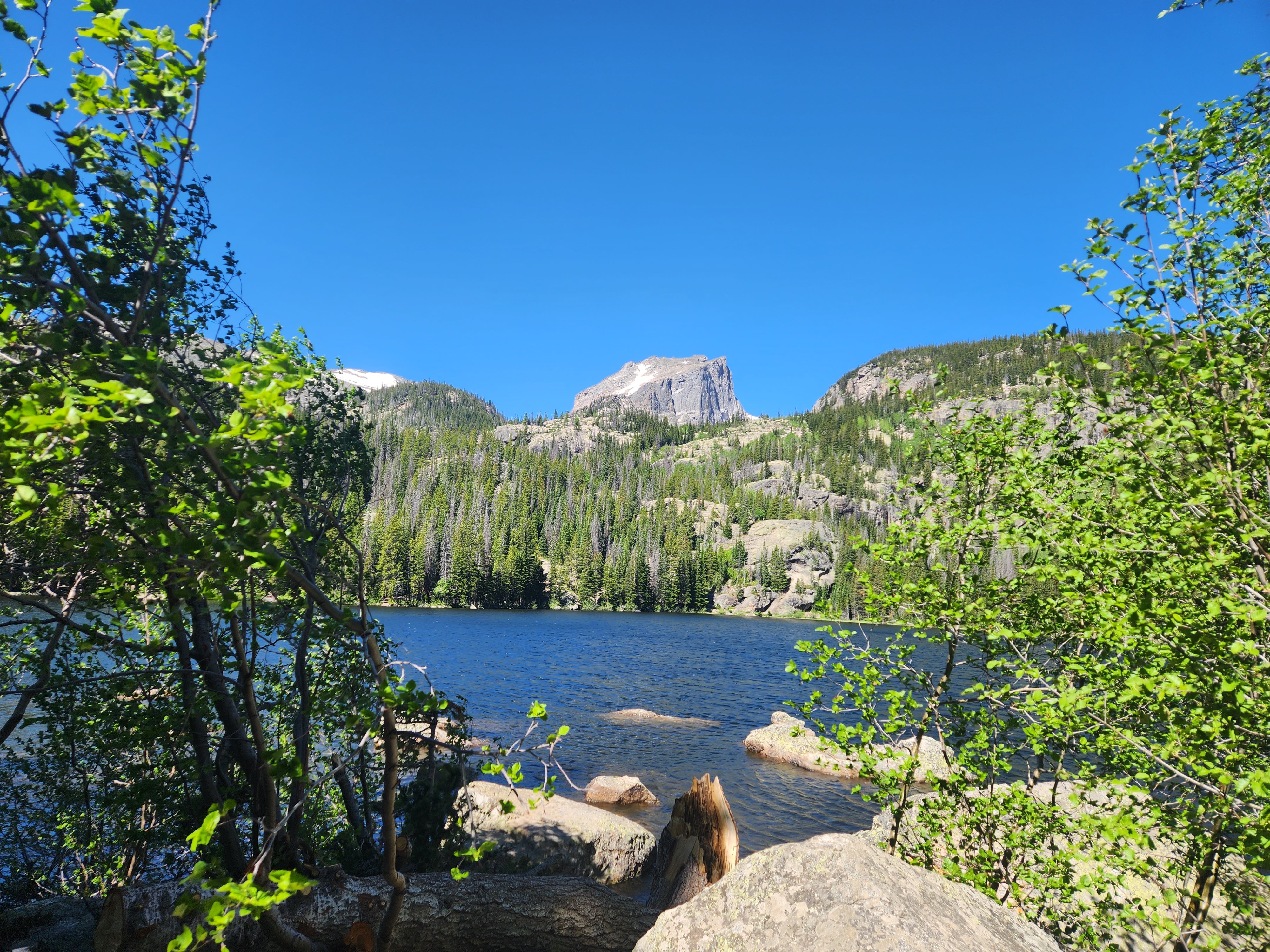
The other thing on my “return list” (which is usually the purpose of these unreasearched first trips) are some hikes. The only paved road in the park, which diverts just before the Lehman Caves, is to Wheeler Peak. It kinda looks like Half Dome, and was formed the same way. Although the hike up to the peak doesn’t look nearly as precarious as its Yosemite brethren.
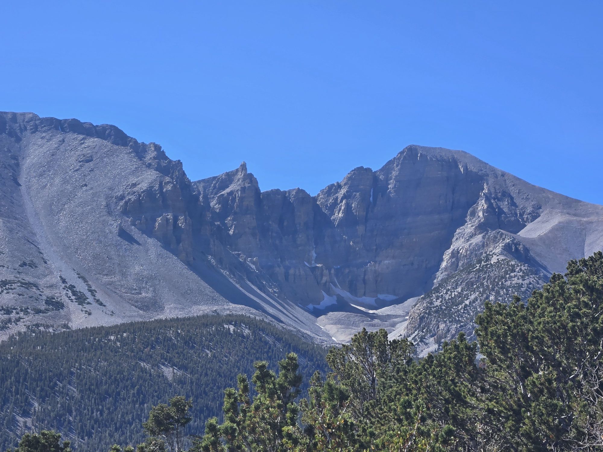
No, that’s not the hike I want to do next time. I don’t care that it’s a standard hike instead of cables that will kill you if you let go. It’s nine miles and a 3,000-foot elevation gain, starting at 10,000 feet. No thanks.
The hike I want to take, instead, scrambles up the snow and rocks toward the front of the mountain. Unlike the behemoth hike around the back side, this one’s “only” five miles with a 1,000-foot elevation gain. That might be doable if I was prepared, and now that I think of it, isn’t Half Dome cooler from the front than the back? Being at the base of a cliff seems more majestic than on top of it. Especially when I can already get views like this without hiking anywhere:
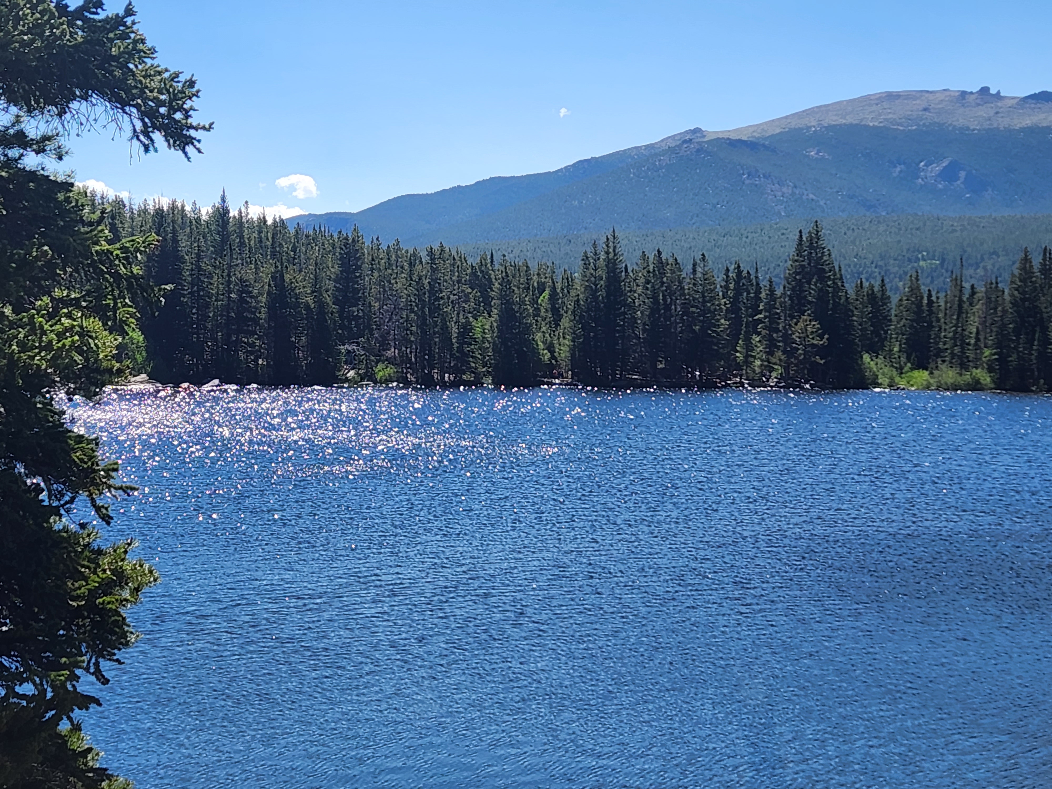
We almost did a shorter hike past a couple of alpine lakes, but opted not to. We only had a little water and no sunscreen, and that sun was scorching up there. It was 100 degrees in the valley that day, and when there isn’t a lot of tree cover, 10,000 feet doesn’t give you a ton of air pressure protecting you, either. As one of my college girlfriends remarked, snow should melt on the mountains “since they’re closer to the sun.”
I wasn’t dating her for her brain.
Plus, we weren’t sure how long the hike would take and we’d already spent primo bucks (8!) for a cave tour in a couple hours. So next time I hit Great Basin, I’m doing a loop that includes both lakes and the glacier on the moraine.
After the park, we hit an archeological dig that would’ve been really cool when it was being excavated. Unfortunately, that was in the early 1990s. When they were done, they filled all the dirt back in, in order to “save it for future generations.” Who will have to dig it up again.
What we were left with was one very torn-apart booklet that explained where in a wide-open desert scrubfield there were some 800-year-old adobe buildings are buried.But we just have to take the book’s word for it.
Highway 50
Finally we headed north to Ely, which I thought was pronounced Elly, but my mom thought was pronounced Eli. We were both wrong. The locals say Ee-Lee. Far be it from me to criticize from afar, but I think that is, obviously, the worst of the options.
Then again, I’ll acquiesce to their demands. They’ve got enough problems. First of which is living in Ely.
Not just because it’s a small town. There are plenty of small towns I would love to live in. Along the Mendocino Coast, maybe, where you have beaches and cliffs and forest all coming together. Maybe someplace in the foothills of Oregon or California, where it only snows two or three times a year – not enough to get sick of and it all melts away so you never have to shovel. The Big Island of Hawaii has some one or two-road towns that could be called paradise.
But high desert amongst the sagebrush? No thanks.
At least Ely had more than one street in their town. The other towns we visited didn’t have that.
Technically, most had at least one street that ran parallel to Highway 50, with some connectors that are best referred to as alleys, but Ely (a town of almost 4,000 residents!) actually had a legitimate T intersection!
Take that, Eureka!
I shouldn’t bag on Eureka. We had a breakfast there that rivaled the one we had in Baker. Same general menu, breakfast sandwiches and burritos, but the sandwich was “build your own.” I opted for a croissant with egg, ham, peppers, onions, and avocado. Solid!
Their coffee options were substantially foofier than in Baker. Options like chocolate hazelnut, cinnamon apple, and chai. While I enjoy a good cappuccino, gimme that chocolate hazelnut.
How did we find this hidden gem? When we got our passport stamped in Ely the night before, the guy at the visitor’s center told us about it. It’s his favorite spot when heading west. So I guess they don’t talk smack about Eureka’s lack of perpendicular streets. When your only claims to fame are being on the loneliest road in America, I guess you develop an affinity for each other.
Unfortunately, the stamp people in Eureka didn’t then give us a secret gem in Austin. I was hoping we’d learn a secret handshake by the end, but most of them were just “here’s your stamp, wanna buy something?”
I also noticed that most of the businesses in those smaller eastern towns sported a “Highway 50 stamp here” sign out front. It’s clearly a draw. However, as we made it farther west, into towns that consider themselves exurbs of Reno don’t give a shit. In those towns we had to go way off Highway 50 to find the Chamber of Commerce or something similar. It’s a good thing I didn’t do my first plan of driving west to east, because I wouldn’t have realized there was a passport until I was halfway done.
Austin was probably the cutest of the towns. It’s more or less smack dab in the middle. A couple houses on the outskirts have “Speed Trap” signs and, sure enough, there was a cop sitting right there on Main Street as we inched through. Part of me thinks it was a setup not to give out tickets, but to get us to slow down enough to spend some money in their town.
After all, I doubt there’s a lot of crime in this town with a population of… huh, Google gives me results ranging from a high of 167 to a low of… one? One person? Is the cop the only inhabitant? Then where the hell do all the other employees in the town live? In the abandoned castle on the outskirts of the town? It’s not like there were a ton of suburbs. Huh, maybe he really was looking to hand out tickets, because he isn’t paying his salary with resident taxes.
As for Highway 50 itself, I’ve been on far lonelier highways. A couple of them on this very trip. Interstate 84, for instance, on the way from Boise to Salt Lake City. Or, for what it’s worth, the portion of Highway 50 in western Utah. Minus the bugs.
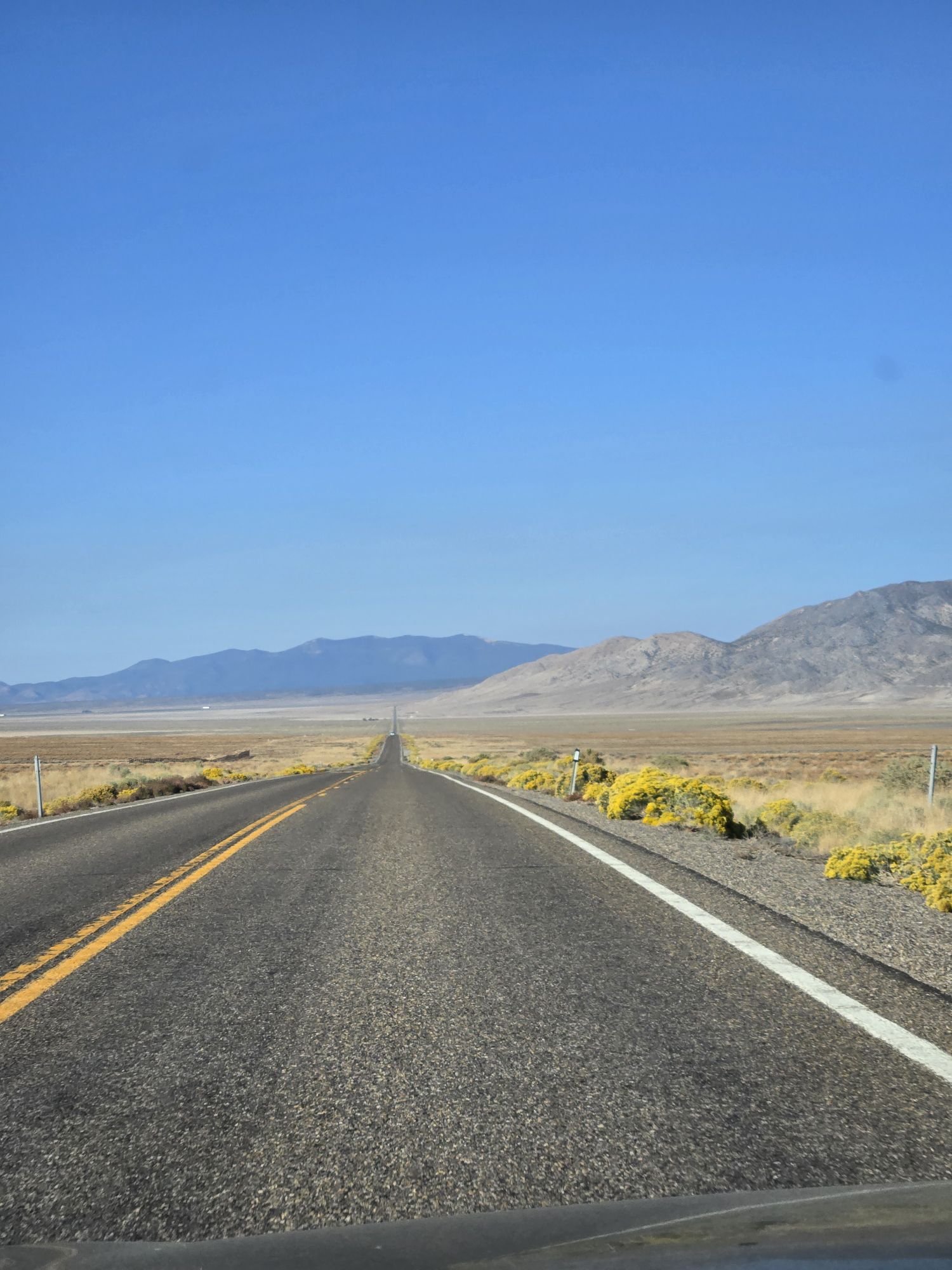
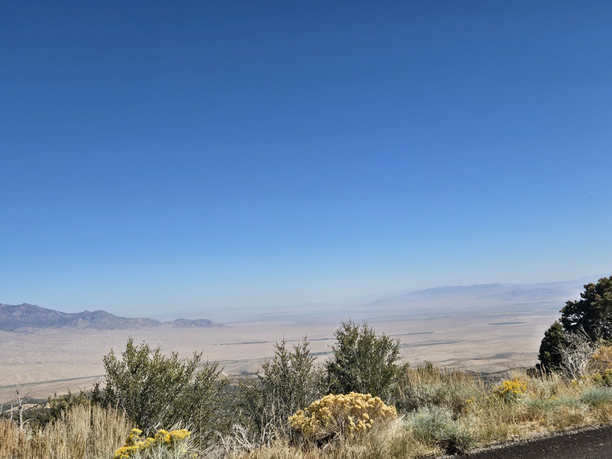
What Highway 50 has that those other highways don’t have, though, are the far-off views. While it looks like it’s flat, you’re actually spending large portions of the journey on long, sloping valleys. This allows you to see ten or twenty miles in front of or behind you at any given time. And the road is straight as all get-out. While there might or might not be other cars in that long vision (usually there were), they were pretty damn far off, and it’ll take forever for them to reach you.
As for cars going the same direction as you, let’s just say it was pretty easy to determine when it was safe to pass them. What was a little bit harder was to determine how fast you were going. Fortunately you should be able to see a cop coming from miles away. Assuming there were more cops on Highway 50 than the “Speed Trap” guy in Arthur. I don’t recall seeing many.
According to the stamp passport, this road got its “Loneliest” designation in 1986 when Life magazine sent some reporters to do a vignette. I guess Baby Jessica hadn’t fallen in the well yet and they needed some hard-hitting picto-journalism.
Kinda makes sense since Life was known for taking grandiose pictures and Highway 50 certainly has majestic visuals. However, the story that went with it said you shouldn’t undertake the journey unless you had desert survival skills. Sheesh, I know 1980s cars weren’t known for distance or longevity, but the longest you ever go between civilization is maybe seventy miles.
Although now that I think about it, my first car was a used 1983 Chrysler LeBaron and that thing would’ve probably only overheated twice in that seventy miles. On a plus side, the hour-and-a-half it would take me to drive that distance at the federally-mandated 55 miles per hour would be almost enough to get the air conditioner to start working.
Still, you can see why they were so keen to push the toddler down the well if all they’ve got in the planning room is “Hey, how about we cover a really long, straight road?”
Nowadays, you can zip through it in a handful of hours without finishing your audiobook or ever stopping for gas.
Although you’re going to want to stop for gas early. The closer we got to Reno, the closer we were to California.
And than means higher gas prices.
Welcome back to civilization, Bitch!